A military-based GPS got a serious workout from Marines and soldiers during the Army’s Network Integration Evaluation 14.2, which took place last month.
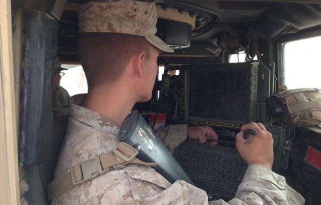
The Joint Battle Command-Platform (JBC-P) is primarily used in vehicles to help reduce the “fog of war” by showing a complete picture of the battlefield so units can synchronize operations. The JBC-P features touch-to-zoom maps, drag-and-drop icons and a Google Earth-like interface, according to a release from the U.S. Army.
Similar to a Global Positioning System used commercially, the capability provides users with the whereabouts of friendly platforms as they travel across the battlefield. Users can also plot the locations of enemy forces and hazards, such as bridges, minefields and explosives. Today, that information is also being delivered down to the dismounted Soldier through the Army’s handheld mission command system, known as Nett Warrior.
Advertisement — Continue Reading Below
“This interface is far more user-friendly,” said 1st Lt. Jeffrey Weinmeister, assistant operations officer with the 2nd Battalion, 8th Marine Regiment said in a release. “It makes it very easy for the first-time user to effectively perform command and control operations. The reliability of the system has allowed us to use it over very difficult terrain here, as well as communicate from significant distances and maintain our situational awareness of the battlefield.”
